Elevation profile
- Walking time
- 1 h 45 mintotal
- Distance
- 4.9 kmLoop
- Ascent
- 184 m
- Highest point
- 1,272 m
About this hike
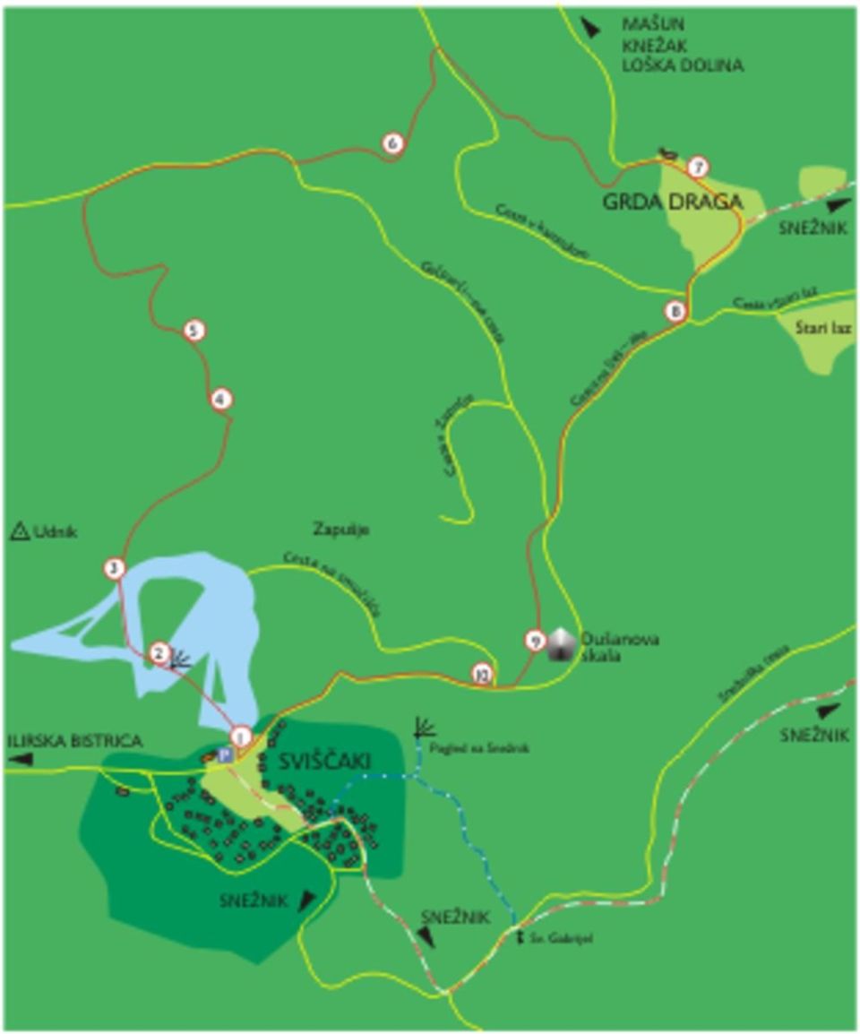
According to PZS (maPZS) the trail starts at the mountain lodge Planinski dom na Sviščakih and has 10 information boards; it is marked by a yellow bear paw print on a red circle. About halfway along is the Grda Draga clearing with a forester's hut, a table and benches. PZS counts the Snežnik forests, together with those of Kočevje and Gorski Kotar, among the largest contiguous forest areas in Europe. The trail is 4.9 km long with 184 m of both ascent and descent, and is managed by the Slovenia Forest Service. Beside the route are Dušanova skala - kamnita miza (20 m), Planinski dom na Sviščakih (30 m), Jelenovo brezno (90 m) and Pogled na Snežnik (110 m, 1,261 m). A car park is 20 m from the start, and there is one toilet along the way.
Frequently asked questions
Where are the table and benches on the Sviščaki trail?
According to PZS they are in the Grda Draga clearing, about halfway along, by the forester's hut.
Where does the trail start, and how do I recognise it?
According to PZS it starts at Planinski dom na Sviščakih. It is marked by a yellow bear paw print on a red circle, and there are 10 information boards.
How demanding is it, and where do I park?
The loop is 4.9 km long with 184 m of ascent and descent, and the highest point is at 1,272 m. A car park is 20 m from the start.
Photos
Difficulty
i
SAC scale from OSM, not an official rating
No data
- DogNo data
- KidsSuitable
Community reports
i
Unverified. User reports never change the official status.
No reports yet.
Log in Report conditions · Add a photo
Spotted a mistake? An editor checks it before anything changes.
Report incorrect data
Spotted a mistake? An editor checks it before anything changes.