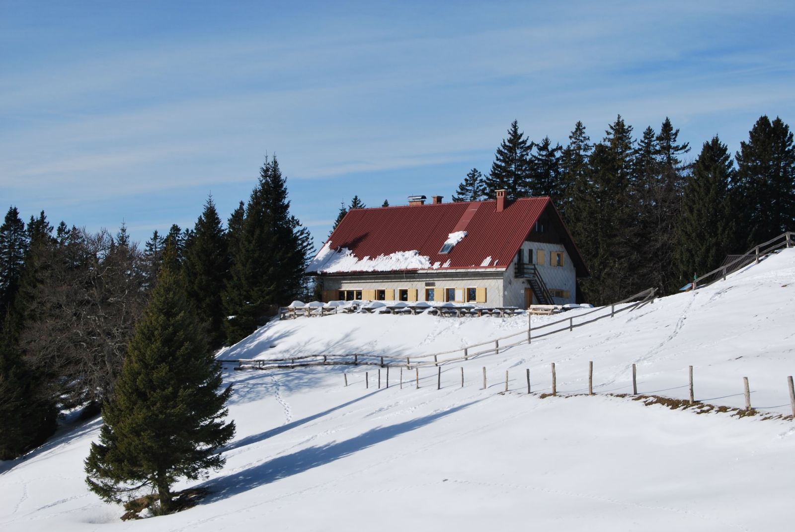
AndrejS.K, CC BY-SA 4.0
Koča na Blegošu
The mountain hut Koča na Blegošu stands on the ridge between the Poljanska and Selška valleys, below the 1,562 m summit of Blegoš.
How to get here 3
i
NaHrib hikes are prepared by our editors. Official approaches are computed on the GURS register of mountain trails (quickest way from a start with parking), ascent from the GURS 12.5 m elevation model, time per DIN 33466. They are not reviewed hikes – check difficulty and conditions before you go.
GURS ZK GJI · GURS DMV 12,5 m (CC BY 4.0)
-
Official mountain trail · computed
Črni kal
Start with parking
1 h 10 min 2.3 km 263 m
-
Official mountain trail · computed
Kaverna na Črnem vrhu nad Novaki
Start with parking
1 h 45 min 4.2 km 275 m
-
Official mountain trail · computed
Leskovica
Start with parking
2 h 20 min 3.7 km 575 m
Official approaches are computed on the GURS trail register; time per DIN 33466 without breaks. Check difficulty and conditions before you go. No listed closure does not mean the trail is open or safe.
About this place
Koča na Blegošu is a mountain hut on the ridge between the Poljanska and Selška valleys, just below the 1,562 m summit of Blegoš. Planinsko društvo Škofja Loka made the hut available to mountaineers in 1977 and enlarged it five years later. Between 2003 and 2006, it was electrified and renovated, and a water supply, water catchment and wastewater treatment plant were put in place. Visitors can get food and drinks at the hut. The association lists an approximate 30-minute walk from the hut to the summit. For current visitor information and seasonal opening hours, check the association’s official website before setting out.
Frequently asked questions
Where is Koča na Blegošu?
On the ridge between the Poljanska and Selška valleys, below the 1,562 m summit of Blegoš.
Who runs Koča na Blegošu?
The hut is run by Planinsko društvo Škofja Loka.
How long is the walk from the hut to the summit of Blegoš?
Planinsko društvo Škofja Loka gives an approximate walking time of 30 minutes from the hut to the summit.
Photos
-
 Koča na Blegošu in a winter landscape. Photo: AndrejS.K, Wikimedia Commons, CC BY-SA 4.0. AndrejS.K, “Koča na Blegošu.jpg”, Wikimedia Commons, CC BY-SA 4.0 (https://creativecommons.org/licenses/by-sa/4.0/). · CC BY-SA 4.0
Community reports
i
Unverified. User reports never change the official status.
No reports yet.
Log in Check-in · Report conditions · Add a photo
Nearby
- Rebulovica Peak · 1,249 m · 0.6 km
- Zavetišče gorske straže na Jelencih Shelter · 1,185 m · 0.6 km
- Blegoš Peak · 1,562 m · 0.7 km
- Špik Peak · 1,538 m · 0.8 km
- Špehovše Peak · 1,355 m · 0.8 km
- Pod robom Peak · 1,258 m · 1.0 km
- Mali Blegoš Peak · 1,114 m · 1.2 km
- Debela peč Peak · 1,171 m · 1.3 km
- Stari vrh Peak · 1,012 m · 1.4 km
- Kovk Peak · 1,274 m · 1.6 km
- Črni kal Parking · 1,104 m · 1.6 km
- Kovk Peak · 1,201 m · 1.7 km
Spotted a mistake or run this place?
Report incorrect data
Spotted a mistake? An editor checks it before anything changes.
Claim this listing
Do you run this hut or place? Send a request and we will verify it by email or phone.