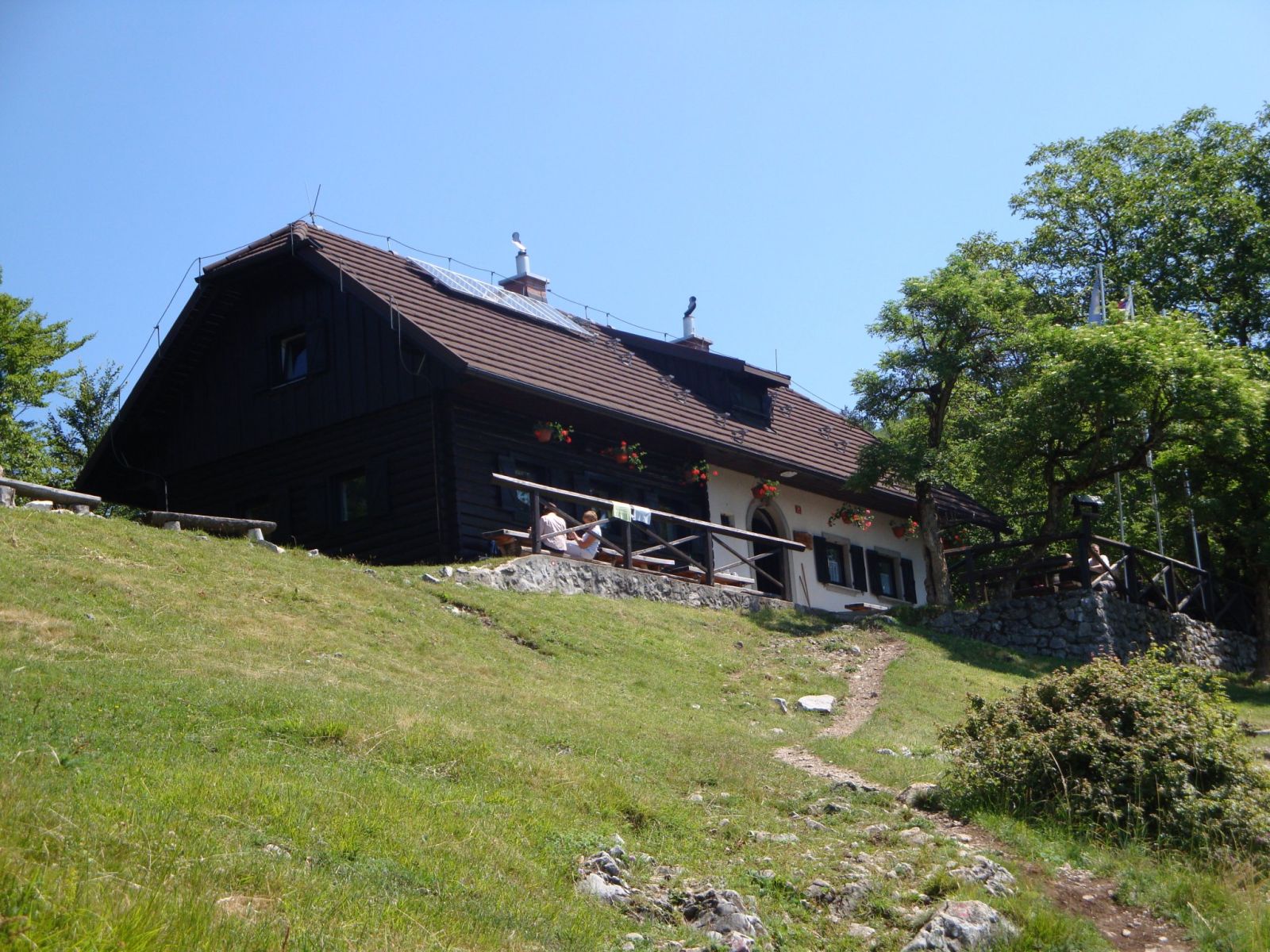
Mich973, CC BY-SA 2.5 SI
How to get here 3
i
NaHrib hikes are prepared by our editors. Official approaches are computed on the GURS register of mountain trails (quickest way from a start with parking), ascent from the GURS 12.5 m elevation model, time per DIN 33466. They are not reviewed hikes – check difficulty and conditions before you go.
GURS ZK GJI · GURS DMV 12,5 m (CC BY 4.0)
-
Official mountain trail · computed
Podagar
Start with parking
1 h 20 min 1.8 km 322 m
-
Official mountain trail · computed
Pod Čemšenikom
Start with parking
3 h 40 min 5.2 km 740 m
-
Official mountain trail · computed
Pod Sv. Lovrencom
Start with parking
5 h 35 min 10 km 898 m
Official approaches are computed on the GURS trail register; time per DIN 33466 without breaks. Check difficulty and conditions before you go. No listed closure does not mean the trail is open or safe.
About this place
The hut stands on the western ridge of Potoška gora, directly beside the Church of St James. The church was first mentioned in 1415, and archaeological finds from the late Roman period have also been discovered nearby. Views from the hut take in Preddvor and the Kokra Valley, stretch across the Gorenjska Plain to the Julian Alps and Triglav, and include Storžič, Zaplata and Kriška gora. The mountain hut was built on the site of a former sacristan’s house after it burned down; the hut was completed and opened on 12 November 1988. The separate Francijeva koča na Sv. Jakobu is nearby: the hut by the church is at Potoče 38, while Francijeva koča is at Potoče 37.
For information about the hut, contact Planinsko društvo Preddvor at preddvorski.planinci@gmail.com.
Frequently asked questions
Where is Planinska koča na Sv. Jakobu?
On the western ridge of Potoška gora, right beside the Church of St James; its address is Potoče 38.
What can you see from the hut?
Views extend across the Gorenjska Plain to the Julian Alps and Triglav, with Storžič, Zaplata and Kriška gora also visible.
When did the hut open?
It was completed and opened on 12 November 1988.
Photos
-
 Planinska koča na Sv. Jakobu, viewed from a grassy slope. Photo: Mich973, 8 July 2010, Wikimedia Commons, CC BY-SA 2.5 SI. Mich973, Planinska koča na Jakobu.jpg, lastno delo, Wikimedia Commons, CC BY-SA 2.5 SI. · CC BY-SA 2.5 SI
Community reports
i
Unverified. User reports never change the official status.
No reports yet.
Log in Check-in · Report conditions · Add a photo
Nearby
- Sv. Jakob Peak · 961 m · 0.1 km
- Francijeva koča Hut · 930 m · 0.2 km
- Razgledna točka nad Sv. Jakobom Viewpoint · 1,071 m · 0.5 km
- Potoška gora Peak · 1,283 m · 1.0 km
- Pod Zaplato Viewpoint · 1,123 m · 1.2 km
- Kozjek Peak · 1,097 m · 1.5 km
- Zavetišče v Hudičevem borštu Hut · 1,328 m · 1.5 km
- Črnava Lake · 470 m · 1.7 km
- Baba Peak · 1,119 m · 1.8 km
- Izvir pod Javorovim vrhom Spring · 1,335 m · 1.9 km
- Vrtičnik Peak · 682 m · 1.9 km
Spotted a mistake or run this place?
Report incorrect data
Spotted a mistake? An editor checks it before anything changes.
Claim this listing
Do you run this hut or place? Send a request and we will verify it by email or phone.