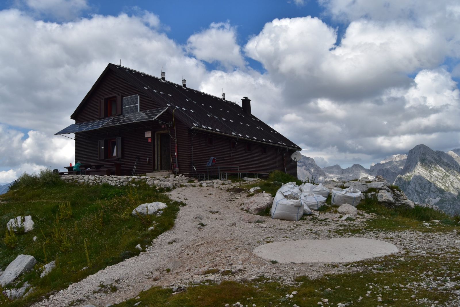
AndrejS.K, CC BY-SA 4.0
Zasavska koča na Prehodavcih
Zasavska koča na Prehodavcih stands on a scenic rise above the Prehodavci pass.
How to get here 2
i
NaHrib hikes are prepared by our editors. Official approaches are computed on the GURS register of mountain trails (quickest way from a start with parking), ascent from the GURS 12.5 m elevation model, time per DIN 33466. They are not reviewed hikes – check difficulty and conditions before you go.
GURS ZK GJI · GURS DMV 12,5 m (CC BY 4.0)
-
Official mountain trail · computed
Planina Blato
Start with parking
5 h 25 min 14 km 1,012 m
-
Official mountain trail · computed
Dom Trenta
Start with parking
6 h 9.9 km 1,421 m
Official approaches are computed on the GURS trail register; time per DIN 33466 without breaks. Check difficulty and conditions before you go. No listed closure does not mean the trail is open or safe.
About this place
Zasavska koča na Prehodavcih stands on a scenic rise above the Prehodavci pass. Mountaineers from the Zasavje region decided to build it in 1952; work began in summer 1953, and the hut opened on 22 August 1954. It was built just above a former Italian border post. Its name reflects the participation of mountaineering clubs from Zasavje in the construction. As the hut became too small, major renovation and expansion began in 1971; the renewed hut opened on 28 July 1973. The following year, in 1974, a wooden shelter called Biserka was built on a nearby bunker. Insulation and a wooden facade were added to the hut in 1985.
For information about the hut, call +386 51 614 781. The mountaineering club Planinsko društvo Radeče can be reached at pdradece@pzs.si.
Frequently asked questions
Where is Zasavska koča na Prehodavcih?
On a scenic rise above the Prehodavci pass.
When did the hut open?
It first opened on 22 August 1954; the renovated and enlarged hut opened on 28 July 1973.
Where can I find official information about the hut?
Call +386 51 614 781 for hut information, or contact the mountaineering club Planinsko društvo Radeče at pdradece@pzs.si.
Photos
-
 Zasavska koča na Prehodavcih, photographed on 16 August 2018. Photo: AndrejS.K, own work, Wikimedia Commons, CC BY-SA 4.0. AndrejS.K, »Zasavska koča na Prehodavcih.jpg«, lastno delo, Wikimedia Commons, CC BY-SA 4.0. · CC BY-SA 4.0
Community reports
i
Unverified. User reports never change the official status.
No reports yet.
Log in Check-in · Report conditions · Add a photo
Nearby
- Bivak na Prehodavcih – zimska soba Shelter · 2,060 m · 0.1 km
- Rjavo jezero Lake · 2,004 m · 0.4 km
- Jezero pod Vršacem Lake · 1,989 m · 0.5 km
- Zadnja Lopa Peak · 2,102 m · 0.5 km
- Vodnikov Vršac Peak · 2,188 m · 0.7 km
- Zeleno jezero Lake · 1,986 m · 0.8 km
- Poprovec Peak · 2,496 m · 0.9 km
- Teme Peak · 2,498 m · 0.9 km
- Vodni vir Spring · 1,221 m · 1.0 km
- Malo Špičje Peak · 2,312 m · 1.0 km
- Jezero pod Vršaki Lake · 2,032 m · 1.0 km
- Kanjavec (zahodni vrh) Peak · 2,569 m · 1.2 km
Spotted a mistake or run this place?
Report incorrect data
Spotted a mistake? An editor checks it before anything changes.
Claim this listing
Do you run this hut or place? Send a request and we will verify it by email or phone.