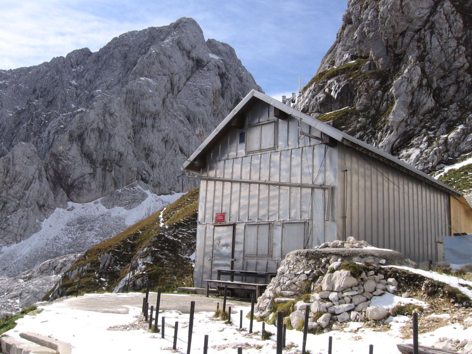
JakobZ, CC BY-SA 3.0
Zavetišče pod Špičkom
Zavetišče pod Špičkom stands at the edge of a scree slope east of the rocky pinnacle Špiček in the Julian Alps.
How to get here 3
i
NaHrib hikes are prepared by our editors. Official approaches are computed on the GURS register of mountain trails (quickest way from a start with parking), ascent from the GURS 12.5 m elevation model, time per DIN 33466. They are not reviewed hikes – check difficulty and conditions before you go.
GURS ZK GJI · GURS DMV 12,5 m (CC BY 4.0)
-
Official mountain trail · computed
Prelaz Vršič
Start with parking
3 h 55 min 6.9 km 738 m
-
Official mountain trail · computed
Zadnja Trenta, Flori
Start with parking
4 h 3.9 km 1,061 m
-
Official mountain trail · computed
Odcep na Soško pot
Start with parking
4 h 30 min 5.7 km 1,136 m
Official approaches are computed on the GURS trail register; time per DIN 33466 without breaks. Check difficulty and conditions before you go. No listed closure does not mean the trail is open or safe.
About this place
Zavetišče pod Špičkom stands at the edge of a scree slope east of the rocky pinnacle Špiček in the Julian Alps. Hikers from Jesenice first set up a shelter in a former Italian military observation post; it opened on 6 August 1950. Increased use led to a new shelter, ceremonially opened on 3 July 1983. The hut is in the high-mountain landscape of Trenta. To reserve an overnight stay, use the official form on the Planinsko društvo Jesenice website; after a successful reservation, the association sends confirmation by email. For current operating information, the association directs visitors to contact the shelter.
Frequently asked questions
Where is Zavetišče pod Špičkom?
At the edge of a scree slope east of the rocky pinnacle Špiček in the Julian Alps.
How do I reserve an overnight stay?
Submit a reservation through the form on the Planinsko društvo Jesenice website. After a successful reservation, you receive confirmation by email.
Where can I check the shelter’s operating information?
Planinsko društvo Jesenice directs visitors to contact the shelter.
Photos
-
 Zavetišče pod Špičkom, with Pelc nad Klonicami in the background. Photographed on 6 October 2006. Photo: JakobZ, Wikimedia Commons, CC BY-SA 3.0. JakobZ, “Zavetishche pod Shpichkom.jpg”, Wikimedia Commons, CC BY-SA 3.0 (https://creativecommons.org/licenses/by-sa/3.0/). · CC BY-SA 3.0
Community reports
i
Unverified. User reports never change the official status.
No reports yet.
Log in Check-in · Report conditions · Add a photo
Nearby
- Špiček Peak · 2,194 m · 0.1 km
- Vrh Zelenic Peak · 2,278 m · 0.4 km
- Veliki Turn Peak · 1,998 m · 0.6 km
- Pelc nad Klonicami Peak · 2,443 m · 0.7 km
- Veliki Ozebnik Peak · 2,480 m · 0.7 km
- Mali Turn Peak · 1,916 m · 0.7 km
- Griva Peak · 1,973 m · 0.7 km
- Mali Turn Peak · 1,882 m · 0.8 km
- Mali Ozebnik Peak · 2,321 m · 0.8 km
- Vrh prodov Peak · 2,051 m · 0.9 km
- Nad steno Peak · 2,186 m · 1.0 km
- Griva Peak · 2,137 m · 1.1 km
Spotted a mistake or run this place?
Report incorrect data
Spotted a mistake? An editor checks it before anything changes.
Claim this listing
Do you run this hut or place? Send a request and we will verify it by email or phone.